 vesseltracker.com
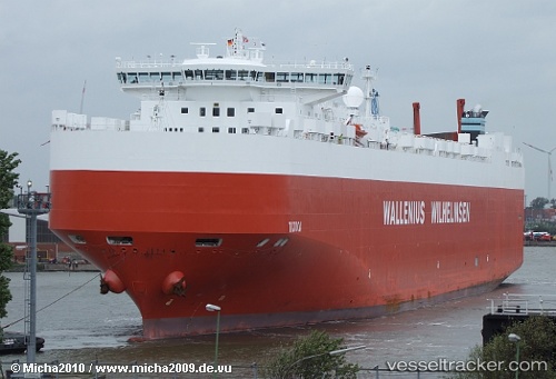
 Tijuca
Current Status
Where is the vessel?
Tijuca is currently in 65 nm SE of Vilanculos, based on AIS data received less than 1h ago.
Latest AIS update:
Current position: 22.69457° S, 36.17128° E (65 nm SE of Vilanculos)
Average speed (last 7 days): Loading…
Average speed (last 30 days): Loading…
Vessel profile: Tijuca is a Vehicles Carrier with dimensions 232m x 32m.
This page combines live AIS, route history, probable destination signals, nearby traffic, and port activity for practical vessel monitoring.
The current position of vessel Tijuca is -22.69457 lat / 36.17128 lng. Updated: 2026-04-28 18:03:46 UTCCurrently sailing under the flag of Norway ![]()
Tijuca built in 2008 year
Deadweight:
30089 tDetails:
Live Vessel Tijuca Analytics (details, animations, etc.)
Recent AIS points (UTC):
2026-04-28 14:16:48 UTC · -22.31549, 36.25700 · SOG 6.1 kn · COG 186°2026-04-28 16:01:57 UTC · -22.49000, 36.22500 · SOG 5 kn · COG -1°
2026-04-28 16:16:53 UTC · -22.51333, 36.21833 · SOG 5 kn · COG -1°
2026-04-28 18:03:46 UTC · -22.69457, 36.17128 · SOG 5.9 kn · COG 186°