 vesseltracker.com
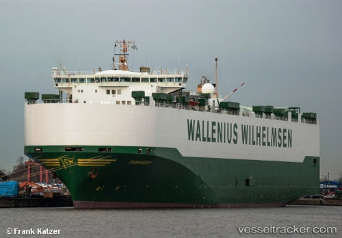
 TURANDOT
Current Status
Where is the vessel?
TURANDOT is currently in 23 nm W of Tanjong Bin, based on AIS data received about 1h ago.
Latest AIS update:
Current position: 1.39810° N, 103.17497° E (23 nm W of Tanjong Bin)
Average speed (last 7 days): Loading…
Average speed (last 30 days): Loading…
Vessel profile: TURANDOT is a Vehicles Carrier with dimensions m x m.
This page combines live AIS, route history, probable destination signals, nearby traffic, and port activity for practical vessel monitoring.
The current position of vessel TURANDOT is 1.39810 lat / 103.17497 lng. Updated: 2026-05-14 20:15:13 UTCNearest reference points:
- 19 nm W of Tanjong Bin
- 15 nm W of Tanjong Bin
- 17 nm NE of Perawang
Currently sailing under the flag of Sweden ![]()
Details:
Live Vessel TURANDOT Analytics (details, animations, etc.)
Recent AIS points (UTC):
2026-05-14 16:58:49 UTC · 1.72119, 102.56660 · SOG 12.1 kn · COG 116°2026-05-14 18:16:09 UTC · 1.60737, 102.80276 · SOG 12.3 kn · COG 115°
2026-05-14 19:14:56 UTC · 1.48675, 102.99001 · SOG 14.4 kn · COG 117°
2026-05-14 20:15:13 UTC · 1.39810, 103.17497 · SOG 13 kn · COG 123°