 vesseltracker.com
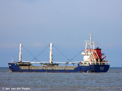
Vessel Unlu 5 IMO: 9334416, MMSI: 271000854 General Cargo Ship
UTC, 37.72148, 16.01655, course: 104, speed: 7.8
UTC, 37.62720, 16.47335, course: 104, speed: 8.5
2026-02-13 11:20:25 UTC, 37.58742, 16.65193, course: 108, speed: 7.8
Live AIS position:
UTC. 38 nm SE of Bianco),
updated 2026-02-13 11:20:25 UTC.
Find the position of the vessel Unlu 5 on the map. The latter are known coordinates and path.
marine traffic ship tracker show on live map
The current position of vessel Unlu 5 is 37.58742 lat / 16.65193 lng. Updated: 2026-02-13 11:20:25 UTCCurrently sailing under the flag of Turkey
Unlu 5 built in 2006 year
Deadweight:
5346 tDetails:
Last coordinates of the vessel:
UTC, 37.78938, 15.76558, course: 119, speed: 7.8UTC, 37.72148, 16.01655, course: 104, speed: 7.8
UTC, 37.62720, 16.47335, course: 104, speed: 8.5
2026-02-13 11:20:25 UTC, 37.58742, 16.65193, course: 108, speed: 7.8