 vesseltracker.com
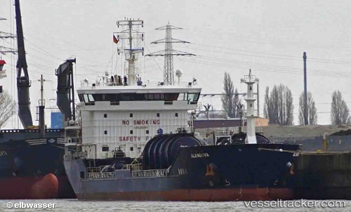
Alangova
Current StatusWhere is the vessel?
Alangova is currently in Near Houston, based on AIS data received less than 1h ago.
Latest AIS update:
Current position: 29.72731° N, 95.27504° W (Near Houston)
Average speed (last 7 days): Loading…
Average speed (last 30 days): Loading…
Vessel profile: Alangova is a Chemical Oil Products Tanker with dimensions 21m x 124m.
This page combines live AIS, route history, probable destination signals, nearby traffic, and port activity for practical vessel monitoring.
The current position of vessel Alangova is 29.72731 lat / -95.27504 lng. Updated: 2026-05-15 16:10:30 UTCNearest reference points:
- Near Pasadena
- Near Jacinto City
- Near Morgan Point
Details:
Live Vessel Alangova Analytics (details, animations, etc.)
Recent AIS points (UTC):
2026-05-15 13:19:46 UTC · 29.74556, -95.28567 · SOG 0 kn · COG 153°2026-05-15 14:01:50 UTC · 29.74555, -95.28568 · SOG 0 kn · COG 153°
2026-05-15 15:52:46 UTC · 29.74554, -95.28567 · SOG 0 kn · COG 153°
2026-05-15 16:10:30 UTC · 29.72731, -95.27504 · SOG 5.3 kn · COG 131°