 vesseltracker.com
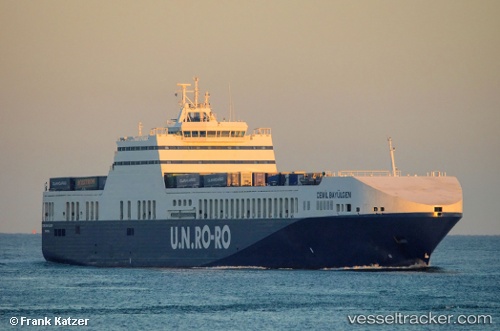
 Cemil Bayulgen
Current Status
Where is the vessel?
Cemil Bayulgen is currently in 71 nm SW of Shinari Zakynthou, based on AIS data received about 1h ago.
Latest AIS update:
Current position: 36.97626° N, 19.75586° E (71 nm SW of Shinari Zakynthou)
Average speed (last 7 days): Loading…
Average speed (last 30 days): Loading…
Vessel profile: Cemil Bayulgen is a Ro Ro Cargo Ship with dimensions 223m x 26m.
This page combines live AIS, route history, probable destination signals, nearby traffic, and port activity for practical vessel monitoring.
The current position of vessel Cemil Bayulgen is 36.97626 lat / 19.75586 lng. Updated: 2026-05-14 14:48:42 UTCNearest reference points:
- 103 nm NE of Ryuo
- 23 nm S of Methoni
- Near Meganísi
Currently sailing under the flag of Turkey ![]()
Cemil Bayulgen built in 2010 year
Deadweight:
11636 tDetails:
Live Vessel Cemil Bayulgen Analytics (details, animations, etc.)
Recent AIS points (UTC):
2026-05-14 13:35:10 UTC · 36.87014, 20.20831 · SOG 18.2 kn · COG 287°2026-05-14 13:40:52 UTC · 36.87804, 20.17346 · SOG 18.4 kn · COG 287°
2026-05-14 14:48:42 UTC · 36.97626, 19.75586 · SOG 18.7 kn · COG 287°
2026-05-14 14:48:42 UTC · 36.97626, 19.75586 · SOG 18.7 kn · COG 287°