 vesseltracker.com
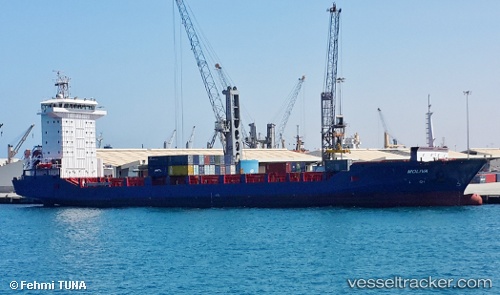
 MOLIVA
Current Status
Where is the vessel?
MOLIVA is currently in 11 nm SW of Sarköy, based on AIS data received less than 1h ago.
Latest AIS update:
Current position: 40.49576° N, 26.91571° E (11 nm SW of Sarköy)
Average speed (last 7 days): Loading…
Average speed (last 30 days): Loading…
Vessel profile: MOLIVA is a Cargo A with dimensions m x m.
This page combines live AIS, route history, probable destination signals, nearby traffic, and port activity for practical vessel monitoring.
The current position of vessel MOLIVA is 40.49576 lat / 26.91571 lng. Updated: 2026-04-25 13:03:25 UTCNearest reference points:
- Near Sarköy
- Near Gelibolu
- Near Dardanelles
Currently sailing under the flag of Turkey ![]()
Details:
Live Vessel MOLIVA Analytics (details, animations, etc.)
Recent AIS points (UTC):
2026-04-25 10:06:04 UTC · 40.61013, 27.16154 · SOG 0 kn · COG 178°2026-04-25 10:09:06 UTC · 40.61008, 27.16159 · SOG 0 kn · COG 179°
2026-04-25 12:25:14 UTC · 40.54174, 27.04018 · SOG 9.9 kn · COG 238°
2026-04-25 13:03:25 UTC · 40.49576, 26.91571 · SOG 9.8 kn · COG 244°