 vesseltracker.com
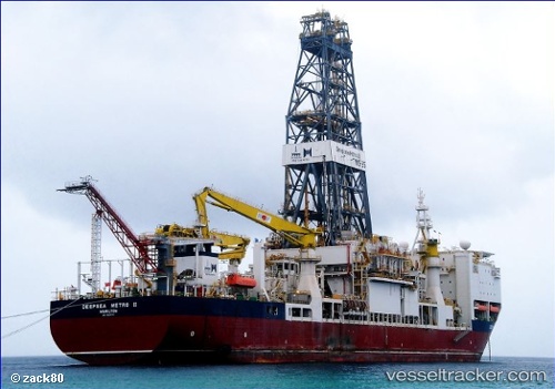
 Fatih
Fatih
Current Status
Where is the vessel?
Fatih is currently in Near Sevastopol, based on AIS data received about 2d ago.
Latest AIS update:
Current position: 44.59691° N, 33.38419° E (Near Sevastopol)
Average speed (last 7 days): Loading…
Average speed (last 30 days): Loading…
Vessel profile: Fatih is a Drilling Ship with dimensions 229m x 36m.
This page combines live AIS, route history, probable destination signals, nearby traffic, and port activity for practical vessel monitoring.
The current position of vessel Fatih is 44.59691 lat / 33.38419 lng. Updated: 2026-04-24 14:59:56 UTCNearest reference points:
- Near Sevastopol
- Near Dorozhnoye
- 14 nm SW of Yalta
Currently sailing under the flag of Turkey ![]()
Fatih built in 2011 year
Deadweight:
34256 tDetails:
Live Vessel Fatih Analytics (details, animations, etc.)
Recent AIS points (UTC):
2026-04-24 14:59:56 UTC · 44.59691, 33.38419 · SOG 14.8 kn · COG 259°2026-04-24 14:59:56 UTC · 44.59691, 33.38419 · SOG 14.8 kn · COG 259°
2026-04-24 14:59:56 UTC · 44.59691, 33.38419 · SOG 14.8 kn · COG 259°
2026-04-24 14:59:56 UTC · 44.59691, 33.38419 · SOG 14.8 kn · COG 259°