 vesseltracker.com
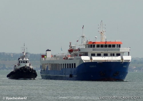
 YENER C
Current Status
Where is the vessel?
YENER C is currently in Near Erdek, based on AIS data received less than 1h ago.
Latest AIS update:
Current position: 40.38730° N, 27.96360° E (Near Erdek)
Average speed (last 7 days): Loading…
Average speed (last 30 days): Loading…
Vessel profile: YENER C is a Passenger/Ro-Ro Ship (vehicles) with dimensions 103m x 16m.
This page combines live AIS, route history, probable destination signals, nearby traffic, and port activity for practical vessel monitoring.
The current position of vessel YENER C is 40.38730 lat / 27.96360 lng. Updated: 2026-05-17 19:29:17 UTCNearest reference points:
- 11 nm E of Erdek
- Near Erdek
- Near Saraylar
Currently sailing under the flag of Turkey ![]()
YENER C built in 2008 year
Deadweight:
1703 tDetails:
Live Vessel YENER C Analytics (details, animations, etc.)
Recent AIS points (UTC):
2026-05-17 16:52:57 UTC · 40.35500, 27.95622 · SOG 0 kn · COG -1°2026-05-17 17:53:15 UTC · 40.35507, 27.95618 · SOG 0 kn · COG -1°
2026-05-17 19:07:46 UTC · 40.35508, 27.95617 · SOG 0 kn · COG -1°
2026-05-17 19:29:17 UTC · 40.38730, 27.96360 · SOG 9.8 kn · COG -1°