 vesseltracker.com
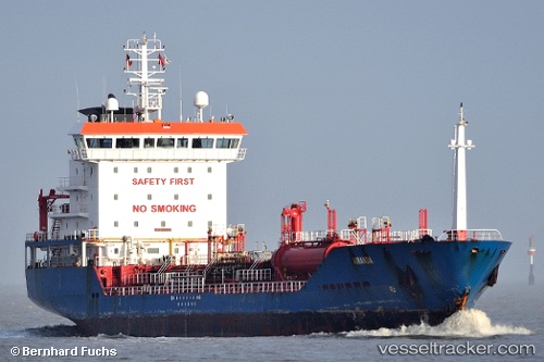
 KARIA
KARIA
Current Status
Where is the vessel?
KARIA is currently in 11 nm SE of Kemer, based on AIS data received about 2h ago.
Latest AIS update:
Current position: 36.42087° N, 30.64925° E (11 nm SE of Kemer)
Average speed (last 7 days): Loading…
Average speed (last 30 days): Loading…
Vessel profile: KARIA is a Chemical/Oil Products Tanker with dimensions 119m x 17m.
This page combines live AIS, route history, probable destination signals, nearby traffic, and port activity for practical vessel monitoring.
The current position of vessel KARIA is 36.42087 lat / 30.64925 lng. Updated: 2026-03-26 15:47:30 UTCNearest reference points:
- Near Kemer
- Near Antalya Free Zone
- Near Antalya
Currently sailing under the flag of Turkey ![]()
KARIA built in 2005 year
Deadweight:
6954 tDetails:
Live Vessel KARIA Analytics (details, animations, etc.)
Recent AIS points (UTC):
2026-03-26 09:21:45 UTC · 36.82497, 30.61302 · SOG 0 kn · COG 159°2026-03-26 11:56:16 UTC · 36.82498, 30.61305 · SOG 0 kn · COG 159°
2026-03-26 14:15:50 UTC · 36.68813, 30.65508 · SOG 9.8 kn · COG 170°
2026-03-26 15:47:30 UTC · 36.42087, 30.64925 · SOG 10.9 kn · COG 188°