 vesseltracker.com
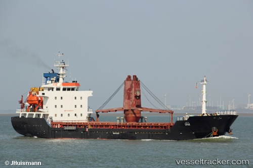
 NECIBE IMAMOGLU
Current Status
Where is the vessel?
NECIBE IMAMOGLU is currently in 34 nm W of Almograve, based on AIS data received less than 1h ago.
Latest AIS update:
Current position: 37.53447° N, 9.50850° W (34 nm W of Almograve)
Average speed (last 7 days): Loading…
Average speed (last 30 days): Loading…
Vessel profile: NECIBE IMAMOGLU is a General Cargo with dimensions m x m.
This page combines live AIS, route history, probable destination signals, nearby traffic, and port activity for practical vessel monitoring.
The current position of vessel NECIBE IMAMOGLU is 37.53447 lat / -9.50850 lng. Updated: 2026-04-26 01:34:27 UTCNearest reference points:
- 31 nm SW of Sagres
- 54 nm W of Sagres
- Near Lagos
Currently sailing under the flag of Turkey ![]()
Details:
Live Vessel NECIBE IMAMOGLU Analytics (details, animations, etc.)
Recent AIS points (UTC):
2026-04-25 18:48:42 UTC · 36.45045, -8.06103 · SOG 7.6 kn · COG 281°2026-04-25 18:48:42 UTC · 36.45045, -8.06103 · SOG 7.6 kn · COG 281°
2026-04-26 00:12:37 UTC · 37.38189, -9.46727 · SOG 7.1 kn · COG 352°
2026-04-26 01:34:27 UTC · 37.53447, -9.50850 · SOG 5.7 kn · COG 351°