 vesseltracker.com
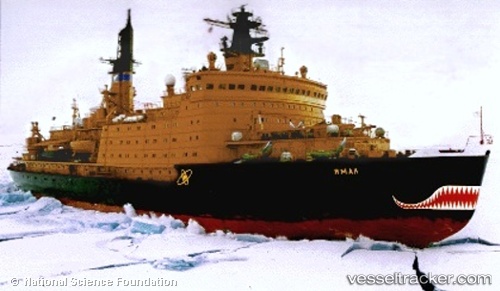
 YAMAL
YAMAL
Current Status
Where is the vessel?
YAMAL is currently in 191 nm NW of Dikson, based on AIS data received less than 1h ago.
Latest AIS update:
Current position: 76.13313° N, 73.57365° E (191 nm NW of Dikson)
Average speed (last 7 days): Loading…
Average speed (last 30 days): Loading…
Vessel profile: YAMAL is a Nuclear Icebreaker with dimensions 30m x 150m.
This page combines live AIS, route history, probable destination signals, nearby traffic, and port activity for practical vessel monitoring.
The current position of vessel YAMAL is 76.13313 lat / 73.57365 lng. Updated: 2026-04-29 17:21:23 UTCCurrently sailing under the flag of Russia ![]()
YAMAL built in 1992 year
Deadweight:
2750 tDetails:
Live Vessel YAMAL Analytics (details, animations, etc.)
Recent AIS points (UTC):
2026-04-29 14:02:05 UTC · 75.79454, 73.97976 · SOG 10.3 kn · COG 34°2026-04-29 16:10:23 UTC · 76.11167, 74.26500 · SOG 9 kn · COG -1°
2026-04-29 16:10:23 UTC · 76.11167, 74.26500 · SOG 9 kn · COG -1°
2026-04-29 17:21:23 UTC · 76.13313, 73.57365 · SOG 8.8 kn · COG 248°