 vesseltracker.com
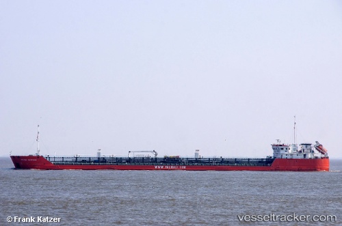
Armada Explorer
Current StatusWhere is the vessel?
Armada Explorer is currently in 46 nm E of Heydar Aliyev International Apt., based on AIS data received about 14h ago.
Latest AIS update:
Current position: 40.35117° N, 51.03183° E (46 nm E of Heydar Aliyev International Apt.)
Average speed (last 7 days): Loading…
Average speed (last 30 days): Loading…
Vessel profile: Armada Explorer is a Chemical Oil Products Tanker with dimensions 16m x 138m.
This page combines live AIS, route history, probable destination signals, nearby traffic, and port activity for practical vessel monitoring.
The current position of vessel Armada Explorer is 40.35117 lat / 51.03183 lng. Updated: 2026-05-14 08:33:49 UTCNearest reference points:
- 27 nm SE of Heydar Aliyev International Apt.
- 12 nm E of Heydar Aliyev International Apt.
- Near Khanlar
Details:
Live Vessel Armada Explorer Analytics (details, animations, etc.)
Recent AIS points (UTC):
2026-05-14 08:33:49 UTC · 40.35117, 51.03183 · SOG 5.5 kn · COG 300°2026-05-14 08:33:49 UTC · 40.35117, 51.03183 · SOG 5.5 kn · COG 300°
2026-05-14 08:33:49 UTC · 40.35117, 51.03183 · SOG 5.5 kn · COG 300°
2026-05-14 08:33:49 UTC · 40.35117, 51.03183 · SOG 5.5 kn · COG 300°