 vesseltracker.com
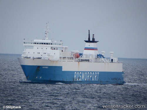
 Baltiysk
Current Status
Where is the vessel?
Baltiysk is currently in Near Ust-Luga, based on AIS data received less than 1h ago.
Latest AIS update:
Current position: 59.76309° N, 28.23684° E (Near Ust-Luga)
Average speed (last 7 days): Loading…
Average speed (last 30 days): Loading…
Vessel profile: Baltiysk is a Ro Ro Cargo Ship with dimensions 187m x 22m.
This page combines live AIS, route history, probable destination signals, nearby traffic, and port activity for practical vessel monitoring.
The current position of vessel Baltiysk is 59.76309 lat / 28.23684 lng. Updated: 2026-04-25 13:01:40 UTCNearest reference points:
- Near Ust-Luga
- Near VISTINO
- Near Ruch’I
Currently sailing under the flag of Russia ![]()
Baltiysk built in 1984 year
Deadweight:
9985 tDetails:
Live Vessel Baltiysk Analytics (details, animations, etc.)
Recent AIS points (UTC):
2026-04-25 10:05:28 UTC · 59.76293, 28.23695 · SOG 0.5 kn · COG 169°2026-04-25 10:05:28 UTC · 59.76293, 28.23695 · SOG 0.5 kn · COG 169°
2026-04-25 12:26:31 UTC · 59.76303, 28.23659 · SOG 0.1 kn · COG 187°
2026-04-25 13:01:40 UTC · 59.76309, 28.23684 · SOG 1 kn · COG 228°