 vesseltracker.com
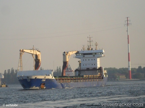
 BERING
Current Status
Where is the vessel?
BERING is currently in 252 nm NE of Matochkin Shar, based on AIS data received less than 1h ago.
Latest AIS update:
Current position: 77.08294° N, 62.60818° E (252 nm NE of Matochkin Shar)
Average speed (last 7 days): Loading…
Average speed (last 30 days): Loading…
Vessel profile: BERING is a Container Ship with dimensions 145m x 19m.
This page combines live AIS, route history, probable destination signals, nearby traffic, and port activity for practical vessel monitoring.
The current position of vessel BERING is 77.08294 lat / 62.60818 lng. Updated: 2026-05-15 16:03:25 UTCCurrently sailing under the flag of Russia ![]()
BERING built in 2003 year
Deadweight:
10649 tDetails:
Live Vessel BERING Analytics (details, animations, etc.)
Recent AIS points (UTC):
2026-05-15 13:42:06 UTC · 76.78427, 61.77555 · SOG 9.9 kn · COG 57°2026-05-15 14:08:13 UTC · 76.82750, 62.02171 · SOG 10 kn · COG 56°
2026-05-15 14:49:54 UTC · 76.89701, 62.40751 · SOG 9.1 kn · COG 56°
2026-05-15 16:03:25 UTC · 77.08294, 62.60818 · SOG 10 kn · COG 16°