 vesseltracker.com
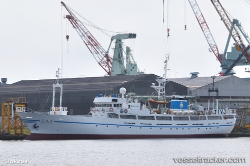
Polaris
Current StatusWhere is the vessel?
Polaris is currently in 62 nm SE of Odaejin, based on AIS data received about 1h ago.
Latest AIS update:
Current position: 40.84667° N, 130.91333° E (62 nm SE of Odaejin)
Average speed (last 7 days): Loading…
Average speed (last 30 days): Loading…
Vessel profile: Polaris is a Training Ship with dimensions 11m x 57m.
This page combines live AIS, route history, probable destination signals, nearby traffic, and port activity for practical vessel monitoring.
The current position of vessel Polaris is 40.84667 lat / 130.91333 lng. Updated: 2026-05-13 21:19:38 UTCNearest reference points:
- 51 nm SE of Odaejin
- 35 nm E of Odaejin
- 10 nm SE of Chongjin
Details:
Live Vessel Polaris Analytics (details, animations, etc.)
Recent AIS points (UTC):
2026-05-13 19:31:36 UTC · 41.11833, 130.95332 · SOG 9 kn · COG -1°2026-05-13 19:43:36 UTC · 41.08833, 130.94833 · SOG 9 kn · COG -1°
2026-05-13 21:19:38 UTC · 40.84667, 130.91333 · SOG 8 kn · COG -1°
2026-05-13 21:19:38 UTC · 40.84667, 130.91333 · SOG 8 kn · COG -1°