 vesseltracker.com
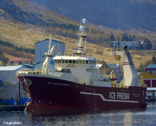
 Vilhelm Torsteinsson
Current Status
Where is the vessel?
Vilhelm Torsteinsson is currently in 95 nm NW of Palana, based on AIS data received about 2h ago.
Latest AIS update:
Current position: 59.77125° N, 157.03149° E (95 nm NW of Palana)
Average speed (last 7 days): Loading…
Average speed (last 30 days): Loading…
Vessel profile: Vilhelm Torsteinsson is a Fishing Vessel with dimensions 79m x 16m.
This page combines live AIS, route history, probable destination signals, nearby traffic, and port activity for practical vessel monitoring.
The current position of vessel Vilhelm Torsteinsson is 59.77125 lat / 157.03149 lng. Updated: 2026-04-29 02:08:37 UTCCurrently sailing under the flag of Russia ![]()
Vilhelm Torsteinsson built in 2000 year
Deadweight:
3860 tDetails:
Live Vessel Vilhelm Torsteinsson Analytics (details, animations, etc.)
Recent AIS points (UTC):
2026-04-28 22:08:39 UTC · 59.90452, 157.25856 · SOG 12.1 kn · COG 333°2026-04-28 23:54:51 UTC · 59.83824, 157.27106 · SOG 2.4 kn · COG 157°
2026-04-29 01:52:08 UTC · 59.77198, 157.15196 · SOG 13.4 kn · COG 274°
2026-04-29 02:08:37 UTC · 59.77125, 157.03149 · SOG 10.7 kn · COG 297°