 vesseltracker.com
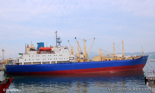
 TAMBOV
Current Status
Where is the vessel?
TAMBOV is currently in Near Vostokmorservice, based on AIS data received less than 1h ago.
Latest AIS update:
Current position: 43.07915° N, 131.81125° E (Near Vostokmorservice)
Average speed (last 7 days): Loading…
Average speed (last 30 days): Loading…
Vessel profile: TAMBOV is a Fish Carrier with dimensions 153m x 22m.
This page combines live AIS, route history, probable destination signals, nearby traffic, and port activity for practical vessel monitoring.
The current position of vessel TAMBOV is 43.07915 lat / 131.81125 lng. Updated: 2026-05-15 16:45:48 UTCNearest reference points:
- Near Vladivostok
- Near Vostokmorservice
- Near Dalzavod
Currently sailing under the flag of Russia ![]()
TAMBOV built in 1982 year
Deadweight:
12243 tDetails:
Live Vessel TAMBOV Analytics (details, animations, etc.)
Recent AIS points (UTC):
2026-05-15 13:25:08 UTC · 43.07916, 131.81140 · SOG 0.1 kn · COG 102°2026-05-15 14:21:10 UTC · 43.07928, 131.81148 · SOG 0.2 kn · COG 106°
2026-05-15 15:49:42 UTC · 43.07948, 131.81152 · SOG 1.9 kn · COG 114°
2026-05-15 16:45:48 UTC · 43.07915, 131.81125 · SOG 0.3 kn · COG 106°