 vesseltracker.com
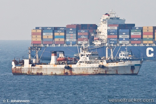
Polluks
Current StatusWhere is the vessel?
Polluks is currently in 38 nm SW of Grossriedenthal, based on AIS data received about 3h ago.
Latest AIS update:
Current position: 48.14333° N, 154.51833° E (38 nm SW of Grossriedenthal)
Average speed (last 7 days): Loading…
Average speed (last 30 days): Loading…
Vessel profile: Polluks is a Fishing Vessel with dimensions 16m x 104m.
This page combines live AIS, route history, probable destination signals, nearby traffic, and port activity for practical vessel monitoring.
The current position of vessel Polluks is 48.14333 lat / 154.51833 lng. Updated: 2026-05-14 23:39:10 UTCNearest reference points:
- Near Severo-Kurilsk
Currently sailing under the flag of
Polluks built in 0 year
Deadweight:
0 tDetails:
Live Vessel Polluks Analytics (details, animations, etc.)
Recent AIS points (UTC):
2026-05-14 20:12:10 UTC · 48.16000, 154.53333 · SOG 7 kn · COG -1°2026-05-14 21:45:58 UTC · 48.10373, 154.43022 · SOG 4.2 kn · COG 257°
2026-05-14 22:17:06 UTC · 48.10715, 154.42343 · SOG 9.9 kn · COG 19°
2026-05-14 23:39:10 UTC · 48.14333, 154.51833 · SOG 4 kn · COG -1°