 vesseltracker.com
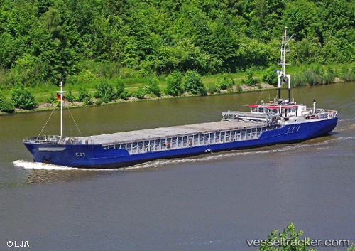
Bonita
Current StatusWhere is the vessel?
Bonita is currently in Near Harrietsham, based on AIS data received less than 1h ago.
Latest AIS update:
Current position: 51.36375° N, 1.02614° E (Near Harrietsham)
Average speed (last 7 days): Loading…
Average speed (last 30 days): Loading…
Vessel profile: Bonita is a General Cargo Ship with dimensions 11m x 66m.
This page combines live AIS, route history, probable destination signals, nearby traffic, and port activity for practical vessel monitoring.
The current position of vessel Bonita is 51.36375 lat / 1.02614 lng. Updated: 2026-04-20 03:43:40 UTCNearest reference points:
- Near Broadstairs
- Near BURNHAM ON CROUCH
- Near RAMSGATE
Details:
Live Vessel Bonita Analytics (details, animations, etc.)
Recent AIS points (UTC):
2026-04-20 00:16:38 UTC · 51.36372, 1.02616 · SOG 0 kn · COG 122°2026-04-20 01:31:35 UTC · 51.36373, 1.02616 · SOG 0 kn · COG 122°
2026-04-20 02:19:39 UTC · 51.36375, 1.02616 · SOG 0 kn · COG 123°
2026-04-20 03:43:40 UTC · 51.36375, 1.02614 · SOG 0 kn · COG 122°