 vesseltracker.com
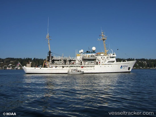
Rainier
Current StatusWhere is the vessel?
Rainier is currently in Near Pearl Harbor, based on AIS data received about 1h ago.
Latest AIS update:
Current position: 21.36604° N, 157.96625° W (Near Pearl Harbor)
Average speed (last 7 days): Loading…
Average speed (last 30 days): Loading…
Vessel profile: Rainier is a Research Vessel with dimensions 12m x 76m.
This page combines live AIS, route history, probable destination signals, nearby traffic, and port activity for practical vessel monitoring.
The current position of vessel Rainier is 21.36604 lat / -157.96625 lng. Updated: 2026-05-14 19:39:20 UTCNearest reference points:
- Near Honolulu
- Near Kaunakakai
- 132 nm SW of Barbers Point
Details:
Live Vessel Rainier Analytics (details, animations, etc.)
Recent AIS points (UTC):
2026-05-14 16:39:19 UTC · 21.36601, -157.96626 · SOG 0 kn · COG 54°2026-05-14 17:39:23 UTC · 21.36603, -157.96623 · SOG 0 kn · COG 54°
2026-05-14 19:21:21 UTC · 21.36603, -157.96622 · SOG 0 kn · COG 54°
2026-05-14 19:39:20 UTC · 21.36604, -157.96625 · SOG 0 kn · COG 54°