 vesseltracker.com
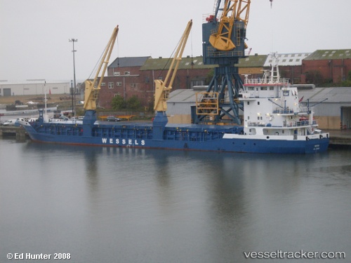
Potosi
Current StatusWhere is the vessel?
Potosi is currently in Near TUZLA, based on AIS data received about 1h ago.
Latest AIS update:
Current position: 40.85274° N, 29.28697° E (Near TUZLA)
Average speed (last 7 days): Loading…
Average speed (last 30 days): Loading…
Vessel profile: Potosi is a Multi Purpose Carrier with dimensions 12m x 88m.
This page combines live AIS, route history, probable destination signals, nearby traffic, and port activity for practical vessel monitoring.
The current position of vessel Potosi is 40.85274 lat / 29.28697 lng. Updated: 2026-04-27 19:59:36 UTCNearest reference points:
- Near TUZLA
- Near Tuzla Free Zone
- Near PENDIK
Details:
Live Vessel Potosi Analytics (details, animations, etc.)
Recent AIS points (UTC):
2026-04-27 16:29:38 UTC · 40.85275, 29.28695 · SOG 0 kn · COG 77°2026-04-27 17:38:38 UTC · 40.85273, 29.28696 · SOG 0 kn · COG 77°
2026-04-27 19:38:37 UTC · 40.85273, 29.28696 · SOG 0 kn · COG 76°
2026-04-27 19:59:36 UTC · 40.85274, 29.28697 · SOG 0 kn · COG 77°