 vesseltracker.com
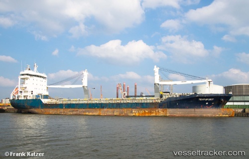
 OHANA
OHANA
Current Status
Where is the vessel?
OHANA is currently in Near St. John’S, based on AIS data received about 1h ago.
Latest AIS update:
Current position: 17.16331° N, 61.84896° W (Near St. John’S)
Average speed (last 7 days): Loading…
Average speed (last 30 days): Loading…
Vessel profile: OHANA is a General Cargo with dimensions m x m.
This page combines live AIS, route history, probable destination signals, nearby traffic, and port activity for practical vessel monitoring.
The current position of vessel OHANA is 17.16331 lat / -61.84896 lng. Updated: 2026-05-17 22:12:25 UTCNearest reference points:
- Near Saint John's
- Near ANTIGUA
- Near Pointe A Pitre
Currently sailing under the flag of Antigua and Barbuda ![]()
Details:
Live Vessel OHANA Analytics (details, animations, etc.)
Recent AIS points (UTC):
2026-05-17 19:06:30 UTC · 17.16689, -61.88765 · SOG 7.4 kn · COG 2°2026-05-17 20:00:46 UTC · 17.16325, -61.84891 · SOG 0.1 kn · COG -1°
2026-05-17 22:03:22 UTC · 17.16330, -61.84896 · SOG 0 kn · COG -1°
2026-05-17 22:12:25 UTC · 17.16331, -61.84896 · SOG 0.1 kn · COG -1°