 vesseltracker.com
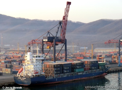
 REGULA
Current Status
Where is the vessel?
REGULA is currently in 20 nm NE of Nagua, based on AIS data received about 2h ago.
Latest AIS update:
Current position: 19.67683° N, 69.66316° W (20 nm NE of Nagua)
Average speed (last 7 days): Loading…
Average speed (last 30 days): Loading…
Vessel profile: REGULA is a Container Ship with dimensions 133m x 19m.
This page combines live AIS, route history, probable destination signals, nearby traffic, and port activity for practical vessel monitoring.
The current position of vessel REGULA is 19.67683 lat / -69.66316 lng. Updated: 2026-05-14 07:07:15 UTCNearest reference points:
- Near Puerto Plata
- 32 nm N of Punta Cana Apt
- 52 nm N of Punta Cana Apt
Currently sailing under the flag of Antigua and Barbuda ![]()
REGULA built in 2008 year
Deadweight:
8509 tDetails:
Live Vessel REGULA Analytics (details, animations, etc.)
Recent AIS points (UTC):
2026-05-14 04:15:31 UTC · 19.53126, -69.03967 · SOG 12.5 kn · COG 284°2026-05-14 05:51:44 UTC · 19.62781, -69.38699 · SOG 13.1 kn · COG 284°
2026-05-14 07:07:15 UTC · 19.67683, -69.66316 · SOG 12.7 kn · COG 284°
2026-05-14 07:07:15 UTC · 19.67683, -69.66316 · SOG 12.7 kn · COG 284°