 vesseltracker.com
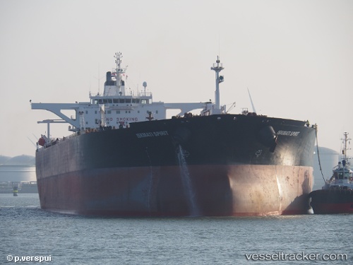
 BLUE
BLUE
Current Status
Where is the vessel?
BLUE is currently in 15 nm S of Palaiá Fókaia, based on AIS data received about 300d ago.
Latest AIS update:
Current position: 37.47008° N, 23.89655° E (15 nm S of Palaiá Fókaia)
Average speed (last 7 days): Loading…
Average speed (last 30 days): Loading…
Vessel profile: BLUE is a Crude Oil Tanker with dimensions 274m x 50m.
This page combines live AIS, route history, probable destination signals, nearby traffic, and port activity for practical vessel monitoring.
The current position of vessel BLUE is 37.47008 lat / 23.89655 lng. Updated: 2025-06-27 09:16:28 UTCNearest reference points:
- Near Methana
- Near LAVRIO MARINA
- Near LAVRIO
Currently sailing under the flag of Antigua Barbuda ![]()
BLUE built in 2003 year
Deadweight:
165293 tDetails:
Live Vessel BLUE Analytics (details, animations, etc.)
Recent AIS points (UTC):
2025-06-27 09:16:28 UTC · 37.47008, 23.89655 · SOG 0 kn · COG 331°