 vesseltracker.com
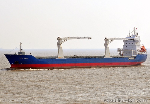
 Unisky
Current Status
Where is the vessel?
Unisky is currently in 44 nm W of Henties Bay (Hentiesbaai), based on AIS data received about 1h ago.
Latest AIS update:
Current position: 22.13469° S, 13.49245° E (44 nm W of Henties Bay (Hentiesbaai))
Average speed (last 7 days): Loading…
Average speed (last 30 days): Loading…
Vessel profile: Unisky is a Multi Purpose Carrier with dimensions 132m x 16m.
This page combines live AIS, route history, probable destination signals, nearby traffic, and port activity for practical vessel monitoring.
The current position of vessel Unisky is -22.13469 lat / 13.49245 lng. Updated: 2026-04-18 23:50:51 UTCNearest reference points:
- Near WALVIS BAY
- 151 nm W of Henties Bay (Hentiesbaai)
- 161 nm W of Walvisbaai
Currently sailing under the flag of Antigua Barbuda ![]()
Unisky built in 2006 year
Deadweight:
9775 tDetails:
Live Vessel Unisky Analytics (details, animations, etc.)
Recent AIS points (UTC):
2026-04-18 17:32:07 UTC · -22.80379, 14.46680 · SOG 11.1 kn · COG 330°2026-04-18 19:23:54 UTC · -22.60564, 14.17823 · SOG 10.6 kn · COG 305°
2026-04-18 21:44:53 UTC · -22.35959, 13.81949 · SOG 10.6 kn · COG 305°
2026-04-18 23:50:51 UTC · -22.13469, 13.49245 · SOG 10.7 kn · COG 305°