 vesseltracker.com
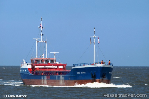
 CM COAST
Current Status
Where is the vessel?
CM COAST is currently in Near Maryton, based on AIS data received less than 1h ago.
Latest AIS update:
Current position: 56.65236° N, 2.47639° W (Near Maryton)
Average speed (last 7 days): Loading…
Average speed (last 30 days): Loading…
Vessel profile: CM COAST is a General Cargo with dimensions m x m.
This page combines live AIS, route history, probable destination signals, nearby traffic, and port activity for practical vessel monitoring.
The current position of vessel CM COAST is 56.65236 lat / -2.47639 lng. Updated: 2026-05-16 01:53:00 UTCNearest reference points:
- Near BROUGHTY FERRY
- Near North Berwick
- Near Aberdeen
Currently sailing under the flag of Antigua and Barbuda ![]()
Details:
Live Vessel CM COAST Analytics (details, animations, etc.)
Recent AIS points (UTC):
2026-05-15 21:26:16 UTC · 56.65222, -2.47627 · SOG 0.3 kn · COG 30°2026-05-15 22:41:05 UTC · 56.65215, -2.47604 · SOG 0 kn · COG 346°
2026-05-15 23:41:15 UTC · 56.65211, -2.47594 · SOG 0.2 kn · COG 18°
2026-05-16 01:53:00 UTC · 56.65236, -2.47639 · SOG 0 kn · COG 14°