 vesseltracker.com
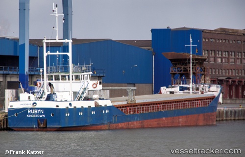
 RUBYN
RUBYN
Current Status
Where is the vessel?
RUBYN is currently in 153 nm SW of YORK, based on AIS data received less than 1h ago.
Latest AIS update:
Current position: 6.15540° N, 14.62200° W (153 nm SW of YORK)
Average speed (last 7 days): Loading…
Average speed (last 30 days): Loading…
Vessel profile: RUBYN is a General Cargo Ship with dimensions 75m x 11m.
This page combines live AIS, route history, probable destination signals, nearby traffic, and port activity for practical vessel monitoring.
The current position of vessel RUBYN is 6.15540 lat / -14.62200 lng. Updated: 2026-04-23 23:54:35 UTCNearest reference points:
- 126 nm SW of YORK
- Near NASSIT
- Near Kissy
Currently sailing under the flag of Antigua and Barbuda ![]()
RUBYN built in 1986 year
Deadweight:
2450 tDetails:
Live Vessel RUBYN Analytics (details, animations, etc.)
Recent AIS points (UTC):
2026-04-23 20:01:07 UTC · 5.71309, -14.32200 · SOG 8 kn · COG 321°2026-04-23 21:42:48 UTC · 5.90891, -14.45189 · SOG 8.4 kn · COG 321°
2026-04-23 22:18:28 UTC · 5.97644, -14.49600 · SOG 8 kn · COG 321°
2026-04-23 23:54:35 UTC · 6.15540, -14.62200 · SOG 8 kn · COG 320°