 vesseltracker.com
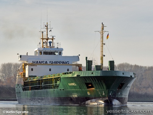
 KARMEL
Current Status
Where is the vessel?
KARMEL is currently in 12 nm NW of Dziwnow, based on AIS data received about 1h ago.
Latest AIS update:
Current position: 54.14141° N, 14.47008° E (12 nm NW of Dziwnow)
Average speed (last 7 days): Loading…
Average speed (last 30 days): Loading…
Vessel profile: KARMEL is a General Cargo with dimensions m x m.
This page combines live AIS, route history, probable destination signals, nearby traffic, and port activity for practical vessel monitoring.
The current position of vessel KARMEL is 54.14141 lat / 14.47008 lng. Updated: 2026-04-23 19:47:17 UTCNearest reference points:
- Near WOLGAST
- Near PEENEMUNDE
- Near Baabe (Ostseebad)
Currently sailing under the flag of Antigua and Barbuda ![]()
Details:
Live Vessel KARMEL Analytics (details, animations, etc.)
Recent AIS points (UTC):
2026-04-23 16:10:36 UTC · 53.65601, 14.54326 · SOG 10.6 kn · COG 324°2026-04-23 18:03:35 UTC · 53.90454, 14.25998 · SOG 8.1 kn · COG 56°
2026-04-23 19:37:06 UTC · 54.11812, 14.43848 · SOG 10.4 kn · COG 40°
2026-04-23 19:47:17 UTC · 54.14141, 14.47008 · SOG 10.9 kn · COG 40°