 vesseltracker.com
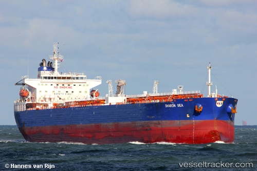
 CHEMTRANS NOVA
Current Status
Where is the vessel?
CHEMTRANS NOVA is currently in 69 nm E of Bommes, based on AIS data received about 1h ago.
Latest AIS update:
Current position: 44.76720° N, 20.40835° W (69 nm E of Bommes)
Average speed (last 7 days): Loading…
Average speed (last 30 days): Loading…
Vessel profile: CHEMTRANS NOVA is a Crude Oil Tanker with dimensions m x m.
This page combines live AIS, route history, probable destination signals, nearby traffic, and port activity for practical vessel monitoring.
The current position of vessel CHEMTRANS NOVA is 44.76720 lat / -20.40835 lng. Updated: 2026-05-15 19:34:08 UTCCurrently sailing under the flag of Antigua and Barbuda ![]()
Details:
Live Vessel CHEMTRANS NOVA Analytics (details, animations, etc.)
Recent AIS points (UTC):
2026-05-15 16:33:33 UTC · 45.00167, -19.64333 · SOG 11 kn · COG -1°2026-05-15 17:21:31 UTC · 44.93833, -19.84833 · SOG 11 kn · COG -1°
2026-05-15 19:34:08 UTC · 44.76720, -20.40835 · SOG 11.7 kn · COG 245°
2026-05-15 19:34:08 UTC · 44.76720, -20.40835 · SOG 11.7 kn · COG 245°