 vesseltracker.com
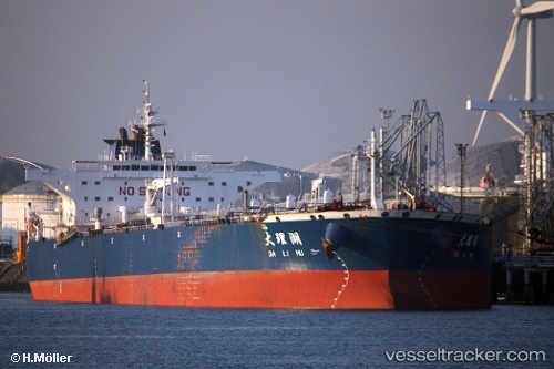
 TAURUS
Current Status
Where is the vessel?
TAURUS is currently in 21 nm S of Tangkak, based on AIS data received less than 1h ago.
Latest AIS update:
Current position: 1.92525° N, 102.48541° E (21 nm S of Tangkak)
Average speed (last 7 days): Loading…
Average speed (last 30 days): Loading…
Vessel profile: TAURUS is a Crude Oil Tanker with dimensions m x m.
This page combines live AIS, route history, probable destination signals, nearby traffic, and port activity for practical vessel monitoring.
The current position of vessel TAURUS is 1.92525 lat / 102.48541 lng. Updated: 2026-05-14 22:31:03 UTCNearest reference points:
- 12 nm S of Tangkak
- 29 nm W of Parit Raja
- Near Malacca
Currently sailing under the flag of Curacao ![]()
Details:
Live Vessel TAURUS Analytics (details, animations, etc.)
Recent AIS points (UTC):
2026-05-14 19:13:07 UTC · 1.92595, 102.48063 · SOG 0.1 kn · COG 83°2026-05-14 20:13:05 UTC · 1.92403, 102.48226 · SOG 0.1 kn · COG 15°
2026-05-14 22:10:07 UTC · 1.92539, 102.48547 · SOG 0 kn · COG 284°
2026-05-14 22:31:03 UTC · 1.92525, 102.48541 · SOG 0 kn · COG 287°