 vesseltracker.com
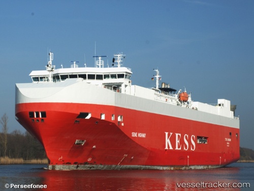
 Seine Highway
Current Status
Where is the vessel?
Seine Highway is currently in 41 nm SW of Dale Roads, based on AIS data received about 1h ago.
Latest AIS update:
Current position: 51.23976° N, 5.94850° W (41 nm SW of Dale Roads)
Average speed (last 7 days): Loading…
Average speed (last 30 days): Loading…
Vessel profile: Seine Highway is a Vehicles Carrier with dimensions 148m x 25m.
This page combines live AIS, route history, probable destination signals, nearby traffic, and port activity for practical vessel monitoring.
The current position of vessel Seine Highway is 51.23976 lat / -5.94850 lng. Updated: 2026-04-18 03:32:32 UTCNearest reference points:
- 10 nm NW of Grampound
- 45 nm SE of Covent Garden
- Near WEXFORD
Currently sailing under the flag of Bahamas ![]()
Seine Highway built in 2007 year
Deadweight:
8100 tDetails:
Live Vessel Seine Highway Analytics (details, animations, etc.)
Recent AIS points (UTC):
2026-04-17 22:18:09 UTC · 52.87487, -5.88013 · SOG 15.5 kn · COG 180°2026-04-17 23:20:45 UTC · 52.59090, -5.87181 · SOG 17.9 kn · COG 183°
2026-04-18 01:21:38 UTC · 51.94494, -5.91985 · SOG 20 kn · COG 180°
2026-04-18 03:32:32 UTC · 51.23976, -5.94850 · SOG 18.4 kn · COG 183°