 vesseltracker.com
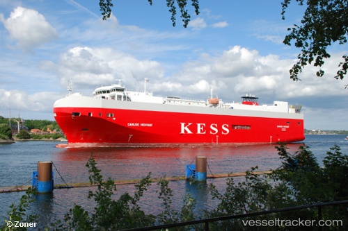
 Danube Highway
Current Status
Where is the vessel?
Danube Highway is currently in 18 nm W of Town Quays/Drogheda, based on AIS data received less than 1h ago.
Latest AIS update:
Current position: 53.71890° N, 5.82212° E (18 nm W of Town Quays/Drogheda)
Average speed (last 7 days): Loading…
Average speed (last 30 days): Loading…
Vessel profile: Danube Highway is a Vehicles Carrier with dimensions 148m x 148m.
This page combines live AIS, route history, probable destination signals, nearby traffic, and port activity for practical vessel monitoring.
The current position of vessel Danube Highway is 53.71890 lat / 5.82212 lng. Updated: 2026-04-19 01:24:42 UTCNearest reference points:
- 14 nm NW of Town Quays/Drogheda
- Near Hempens
- Near LEEUWARDEN
Currently sailing under the flag of Bahamas ![]()
Danube Highway built in 2006 year
Deadweight:
7788 tDetails:
Live Vessel Danube Highway Analytics (details, animations, etc.)
Recent AIS points (UTC):
2026-04-18 19:21:40 UTC · 53.34167, 7.19833 · SOG 0 kn · COG -1°2026-04-18 21:38:11 UTC · 53.36334, 6.97967 · SOG 12.5 kn · COG 340°
2026-04-18 23:51:51 UTC · 53.67341, 6.31519 · SOG 15.3 kn · COG 341°
2026-04-19 01:24:42 UTC · 53.71890, 5.82212 · SOG 13.8 kn · COG 250°