 vesseltracker.com
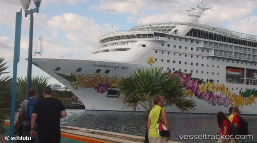
Norwegian Sky
Current StatusWhere is the vessel?
Norwegian Sky is currently in Near Hamburg-Mitte, based on AIS data received less than 1h ago.
Latest AIS update:
Current position: 53.53814° N, 9.99536° E (Near Hamburg-Mitte)
Average speed (last 7 days): Loading…
Average speed (last 30 days): Loading…
Vessel profile: Norwegian Sky is a Cruise Ship with dimensions 32m x 259m.
This page combines live AIS, route history, probable destination signals, nearby traffic, and port activity for practical vessel monitoring.
The current position of vessel Norwegian Sky is 53.53814 lat / 9.99536 lng. Updated: 2026-04-23 19:40:58 UTCNearest reference points:
- Near Hamburg-Mitte
- Near Bahrenfeld
- Near Allermöhe
Details:
Live Vessel Norwegian Sky Analytics (details, animations, etc.)
Recent AIS points (UTC):
2026-04-23 16:07:47 UTC · 53.53813, 9.99535 · SOG 0 kn · COG 269°2026-04-23 16:10:45 UTC · 53.53814, 9.99535 · SOG 0 kn · COG 269°
2026-04-23 18:01:51 UTC · 53.53815, 9.99535 · SOG 0 kn · COG 269°
2026-04-23 19:40:58 UTC · 53.53814, 9.99536 · SOG 0 kn · COG 269°