 vesseltracker.com
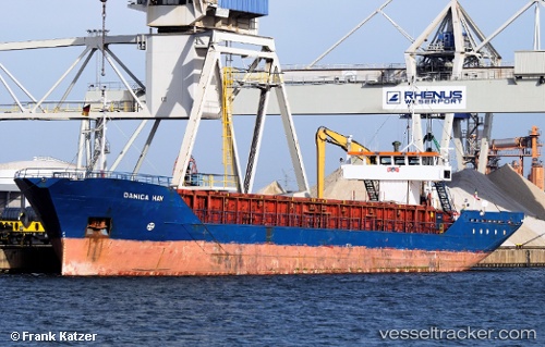
 Danica Hav
Current Status
Where is the vessel?
Danica Hav is currently in Near FREDERIKSVAERK, based on AIS data received less than 1h ago.
Latest AIS update:
Current position: 55.96281° N, 12.01413° E (Near FREDERIKSVAERK)
Average speed (last 7 days): Loading…
Average speed (last 30 days): Loading…
Vessel profile: Danica Hav is a Multi Purpose Carrier with dimensions 82m x 82m.
This page combines live AIS, route history, probable destination signals, nearby traffic, and port activity for practical vessel monitoring.
The current position of vessel Danica Hav is 55.96281 lat / 12.01413 lng. Updated: 2026-04-24 05:54:50 UTCNearest reference points:
- Near HUNDESTED
- 11 nm NW of Tisvilde
- Near Jyllinge
Currently sailing under the flag of Bahamas ![]()
Danica Hav built in 1984 year
Deadweight:
1720 tDetails:
Live Vessel Danica Hav Analytics (details, animations, etc.)
Recent AIS points (UTC):
2026-04-24 00:41:07 UTC · 56.09440, 11.17499 · SOG 8.3 kn · COG 24°2026-04-24 03:48:50 UTC · 55.96276, 12.01410 · SOG 0 kn · COG 334°
2026-04-24 04:30:51 UTC · 55.96279, 12.01406 · SOG 0 kn · COG 334°
2026-04-24 05:54:50 UTC · 55.96281, 12.01413 · SOG 0 kn · COG 334°