 vesseltracker.com
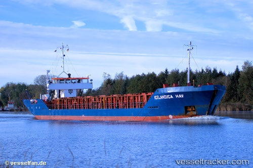
 Icelandicahav
Current Status
Where is the vessel?
Icelandicahav is currently in Near Saint-Malo, based on AIS data received about 1h ago.
Latest AIS update:
Current position: 48.65017° N, 2.01660° W (Near Saint-Malo)
Average speed (last 7 days): Loading…
Average speed (last 30 days): Loading…
Vessel profile: Icelandicahav is a Multi Purpose Carrier with dimensions 82m x 11m.
This page combines live AIS, route history, probable destination signals, nearby traffic, and port activity for practical vessel monitoring.
The current position of vessel Icelandicahav is 48.65017 lat / -2.01660 lng. Updated: 2026-04-28 19:52:37 UTCNearest reference points:
- Near Saint-Malo
- Near SAINT MALO
- Near SAINT CAST LE GUIDO
Currently sailing under the flag of Bahamas ![]()
Icelandicahav built in 1982 year
Deadweight:
2325 tDetails:
Live Vessel Icelandicahav Analytics (details, animations, etc.)
Recent AIS points (UTC):
2026-04-28 15:34:36 UTC · 48.65017, -2.01659 · SOG 0 kn · COG 261°2026-04-28 16:40:37 UTC · 48.65018, -2.01658 · SOG 0 kn · COG 261°
2026-04-28 18:04:36 UTC · 48.65013, -2.01660 · SOG 0 kn · COG 261°
2026-04-28 19:52:37 UTC · 48.65017, -2.01660 · SOG 0 kn · COG 261°