 vesseltracker.com
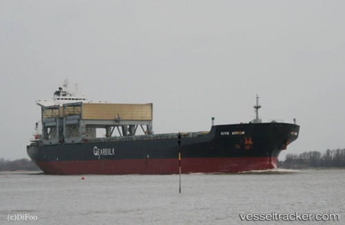
Kite Arrow
Current StatusWhere is the vessel?
Kite Arrow is currently in Near PORTLAND-AU, based on AIS data received less than 1h ago.
Latest AIS update:
Current position: 38.35154° S, 141.61871° E (Near PORTLAND-AU)
Average speed (last 7 days): Loading…
Average speed (last 30 days): Loading…
Vessel profile: Kite Arrow is a Multi Purpose Carrier with dimensions 32m x 200m.
This page combines live AIS, route history, probable destination signals, nearby traffic, and port activity for practical vessel monitoring.
The current position of vessel Kite Arrow is -38.35154 lat / 141.61871 lng. Updated: 2026-04-24 03:36:14 UTCDetails:
Live Vessel Kite Arrow Analytics (details, animations, etc.)
Recent AIS points (UTC):
2026-04-24 00:15:17 UTC · -38.32789, 141.69789 · SOG 0.1 kn · COG 352°2026-04-24 02:09:52 UTC · -38.32850, 141.68452 · SOG 7.3 kn · COG 251°
2026-04-24 02:21:41 UTC · -38.33515, 141.65697 · SOG 6.5 kn · COG 266°
2026-04-24 03:36:14 UTC · -38.35154, 141.61871 · SOG 0 kn · COG 17°