 vesseltracker.com
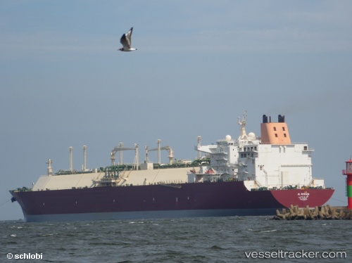
Al Ruwais
Current StatusWhere is the vessel?
Al Ruwais is currently in 206 nm SE of Ile Desroches, based on AIS data received about 1h ago.
Latest AIS update:
Current position: 8.79443° S, 55.14000° E (206 nm SE of Ile Desroches)
Average speed (last 7 days): Loading…
Average speed (last 30 days): Loading…
Vessel profile: Al Ruwais is a Lng Tanker with dimensions 50m x 315m.
This page combines live AIS, route history, probable destination signals, nearby traffic, and port activity for practical vessel monitoring.
The current position of vessel Al Ruwais is -8.79443 lat / 55.14000 lng. Updated: 2026-05-14 19:24:19 UTCNearest reference points:
- 217 nm SE of Ile Desroches
- 130 nm S of Ile Desroches
- Open sea, approx. 404 nm off the nearest listed port
Details:
Live Vessel Al Ruwais Analytics (details, animations, etc.)
Recent AIS points (UTC):
2026-05-14 16:19:11 UTC · -8.78913, 55.26364 · SOG 2 kn · COG 206°2026-05-14 17:30:42 UTC · -8.79008, 55.21487 · SOG 2.5 kn · COG 201°
2026-05-14 19:24:19 UTC · -8.79443, 55.14000 · SOG 2.6 kn · COG 219°
2026-05-14 19:24:19 UTC · -8.79443, 55.14000 · SOG 2.6 kn · COG 219°