 vesseltracker.com
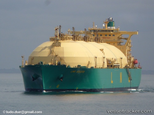
 Lng Sokoto
Current Status
Where is the vessel?
Lng Sokoto is currently in 261 nm W of JAIGAD, based on AIS data received less than 1h ago.
Latest AIS update:
Current position: 16.46512° N, 68.76473° E (261 nm W of JAIGAD)
Average speed (last 7 days): Loading…
Average speed (last 30 days): Loading…
Vessel profile: Lng Sokoto is a Lng Tanker with dimensions 288m x 48m.
This page combines live AIS, route history, probable destination signals, nearby traffic, and port activity for practical vessel monitoring.
The current position of vessel Lng Sokoto is 16.46512 lat / 68.76473 lng. Updated: 2026-04-30 17:49:43 UTCNearest reference points:
- 282 nm W of RATNAGIRI
- 236 nm SW of Veraval
- 306 nm SW of Veraval
Currently sailing under the flag of Bermuda ![]()
Lng Sokoto built in 2002 year
Deadweight:
79822 tDetails:
Live Vessel Lng Sokoto Analytics (details, animations, etc.)
Recent AIS points (UTC):
2026-04-30 14:21:23 UTC · 17.21670, 69.02609 · SOG 13.9 kn · COG 199°2026-04-30 15:52:03 UTC · 16.89305, 68.89342 · SOG 13.7 kn · COG 200°
2026-04-30 16:36:03 UTC · 16.73204, 68.84370 · SOG 13.7 kn · COG 195°
2026-04-30 17:49:43 UTC · 16.46512, 68.76473 · SOG 13.3 kn · COG 201°