 vesseltracker.com
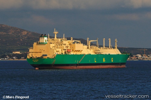
Lng Benue
Current StatusWhere is the vessel?
Lng Benue is currently in 168 nm N of Port Mathurin, based on AIS data received less than 1h ago.
Latest AIS update:
Current position: 16.88833° S, 63.59500° E (168 nm N of Port Mathurin)
Average speed (last 7 days): Loading…
Average speed (last 30 days): Loading…
Vessel profile: Lng Benue is a Lng Tanker with dimensions 42m x 285m.
This page combines live AIS, route history, probable destination signals, nearby traffic, and port activity for practical vessel monitoring.
The current position of vessel Lng Benue is -16.88833 lat / 63.59500 lng. Updated: 2026-04-25 00:22:40 UTCNearest reference points:
- 154 nm NE of Port Mathurin
- 241 nm N of Port Mathurin
- 219 nm NW of Port Mathurin
Details:
Live Vessel Lng Benue Analytics (details, animations, etc.)
Recent AIS points (UTC):
2026-04-24 20:10:45 UTC · -16.61833, 63.98333 · SOG 6 kn · COG -1°2026-04-24 21:34:38 UTC · -16.70667, 63.85167 · SOG 6 kn · COG -1°
2026-04-24 22:35:12 UTC · -16.76909, 63.76221 · SOG 6.5 kn · COG 226°
2026-04-25 00:22:40 UTC · -16.88833, 63.59500 · SOG 6 kn · COG -1°