 vesseltracker.com
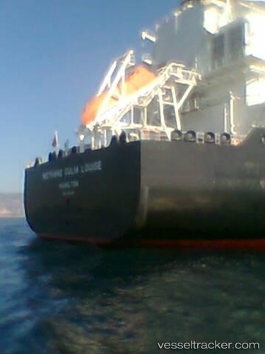
Methane Julia Louise
Current StatusWhere is the vessel?
Methane Julia Louise is currently in 139 nm SE of Saint George, based on AIS data received less than 1h ago.
Latest AIS update:
Current position: 31.31805° N, 62.27222° W (139 nm SE of Saint George)
Average speed (last 7 days): Loading…
Average speed (last 30 days): Loading…
Vessel profile: Methane Julia Louise is a Lng Tanker with dimensions 45m x 290m.
This page combines live AIS, route history, probable destination signals, nearby traffic, and port activity for practical vessel monitoring.
The current position of vessel Methane Julia Louise is 31.31805 lat / -62.27222 lng. Updated: 2026-04-24 12:02:36 UTCNearest reference points:
- 247 nm E of Saint George
Details:
Live Vessel Methane Julia Louise Analytics (details, animations, etc.)
Recent AIS points (UTC):
2026-04-24 07:54:20 UTC · 30.88667, -63.58500 · SOG 17 kn · COG -1°2026-04-24 09:18:18 UTC · 31.03833, -63.14500 · SOG 17 kn · COG -1°
2026-04-24 11:03:21 UTC · 31.21500, -62.58667 · SOG 17 kn · COG -1°
2026-04-24 12:02:36 UTC · 31.31805, -62.27222 · SOG 17.4 kn · COG 68°