 vesseltracker.com
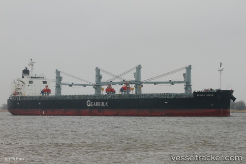
Misago Arrow
Current StatusWhere is the vessel?
Misago Arrow is currently in Near Fray Luis A. Beltrán, based on AIS data received about 1h ago.
Latest AIS update:
Current position: 32.77648° S, 60.71221° W (Near Fray Luis A. Beltrán)
Average speed (last 7 days): Loading…
Average speed (last 30 days): Loading…
Vessel profile: Misago Arrow is a Bulk Carrier with dimensions 32m x 200m.
This page combines live AIS, route history, probable destination signals, nearby traffic, and port activity for practical vessel monitoring.
The current position of vessel Misago Arrow is -32.77648 lat / -60.71221 lng. Updated: 2026-05-01 19:38:37 UTCNearest reference points:
- Near Quebracho/San Lorenzo
- Near Puerto Alumbrera
- 10 nm NW of San Pedro
Details:
Live Vessel Misago Arrow Analytics (details, animations, etc.)
Recent AIS points (UTC):
2026-05-01 16:21:05 UTC · -32.77500, -60.71167 · SOG 0 kn · COG -1°2026-05-01 18:23:33 UTC · -32.77655, -60.71216 · SOG 0 kn · COG 341°
2026-05-01 19:21:05 UTC · -32.77500, -60.71167 · SOG 0 kn · COG -1°
2026-05-01 19:38:37 UTC · -32.77648, -60.71221 · SOG 0 kn · COG 343°