 vesseltracker.com
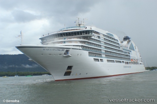
 Seabourn Encore
Current Status
Where is the vessel?
Seabourn Encore is currently in 47 nm NW of PORT HARDY, based on AIS data received about 1h ago.
Latest AIS update:
Current position: 51.24969° N, 128.38110° W (47 nm NW of PORT HARDY)
Average speed (last 7 days): Loading…
Average speed (last 30 days): Loading…
Vessel profile: Seabourn Encore is a Cruise Ship with dimensions 211m x 36m.
This page combines live AIS, route history, probable destination signals, nearby traffic, and port activity for practical vessel monitoring.
The current position of vessel Seabourn Encore is 51.24969 lat / -128.38110 lng. Updated: 2026-05-15 20:08:14 UTCNearest reference points:
- 29 nm NW of Coal Harbour
- 63 nm N of PORT HARDY
- Near PORT HARDY
Currently sailing under the flag of Bahamas ![]()
Details:
Live Vessel Seabourn Encore Analytics (details, animations, etc.)
Recent AIS points (UTC):
2026-05-15 16:43:09 UTC · 50.75503, -127.16949 · SOG 16.8 kn · COG 290°2026-05-15 18:10:27 UTC · 50.94680, -127.72149 · SOG 17 kn · COG 310°
2026-05-15 19:46:37 UTC · 51.19372, -128.25308 · SOG 16.2 kn · COG 304°
2026-05-15 20:08:14 UTC · 51.24969, -128.38110 · SOG 16.6 kn · COG 304°