 vesseltracker.com
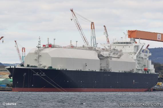
 Nohshu Maru
Current Status
Where is the vessel?
Nohshu Maru is currently in 138 nm SE of KANNOURA, based on AIS data received less than 1h ago.
Latest AIS update:
Current position: 31.47533° N, 135.48598° E (138 nm SE of KANNOURA)
Average speed (last 7 days): Loading…
Average speed (last 30 days): Loading…
Vessel profile: Nohshu Maru is a Lng Tanker with dimensions 298m x 298m.
This page combines live AIS, route history, probable destination signals, nearby traffic, and port activity for practical vessel monitoring.
The current position of vessel Nohshu Maru is 31.47533 lat / 135.48598 lng. Updated: 2026-04-28 10:25:37 UTCNearest reference points:
- 88 nm SE of Minachi
- 40 nm SW of Minachi
- 195 nm SE of Minachi
Currently sailing under the flag of Bahamas ![]()
Details:
Live Vessel Nohshu Maru Analytics (details, animations, etc.)
Recent AIS points (UTC):
2026-04-28 07:25:34 UTC · 31.49333, 135.42833 · SOG 0 kn · COG -1°2026-04-28 07:41:52 UTC · 31.49372, 135.43263 · SOG 0.8 kn · COG 161°
2026-04-28 09:34:44 UTC · 31.48341, 135.46733 · SOG 1.2 kn · COG 156°
2026-04-28 10:25:37 UTC · 31.47533, 135.48598 · SOG 1.4 kn · COG 149°