 vesseltracker.com
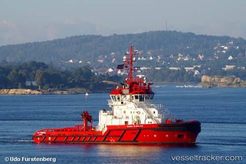
 SD POWER
Current Status
Where is the vessel?
SD POWER is currently in 61 nm NE of Enmore, based on AIS data received about 1h ago.
Latest AIS update:
Current position: 7.57500° N, 57.36333° W (61 nm NE of Enmore)
Average speed (last 7 days): Loading…
Average speed (last 30 days): Loading…
Vessel profile: SD POWER is a Tug with dimensions 41m x 15m.
This page combines live AIS, route history, probable destination signals, nearby traffic, and port activity for practical vessel monitoring.
The current position of vessel SD POWER is 7.57500 lat / -57.36333 lng. Updated: 2026-04-28 04:12:25 UTCNearest reference points:
- 57 nm NE of Adventure
- 38 nm NW of Jarikaba
- Near Paramaribo Zorg en Hoop Airport
Currently sailing under the flag of Bahamas ![]()
SD POWER built in 2015 year
Deadweight:
450 tDetails:
Live Vessel SD POWER Analytics (details, animations, etc.)
Recent AIS points (UTC):
2026-04-28 01:55:45 UTC · 7.41254, -57.53261 · SOG 6.3 kn · COG 56°2026-04-28 01:57:35 UTC · 7.41463, -57.53052 · SOG 5.9 kn · COG 61°
2026-04-28 03:24:25 UTC · 7.51667, -57.42333 · SOG 5 kn · COG -1°
2026-04-28 04:12:25 UTC · 7.57500, -57.36333 · SOG 6 kn · COG -1°