 vesseltracker.com
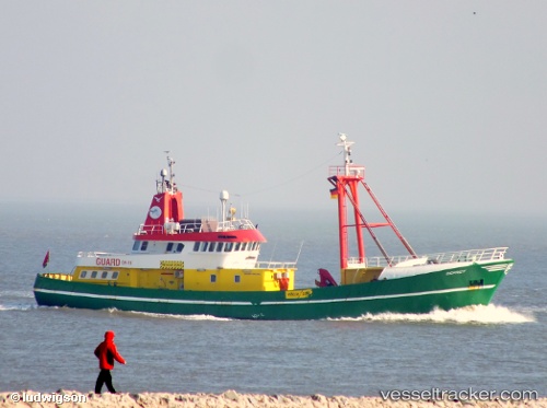
 OSPREY
Current Status
Where is the vessel?
OSPREY is currently in Near Foynes, based on AIS data received about 4h ago.
Latest AIS update:
Current position: 52.61671° N, 9.09957° W (Near Foynes)
Average speed (last 7 days): Loading…
Average speed (last 30 days): Loading…
Vessel profile: OSPREY is a Utility Vessel with dimensions 8m x 42m.
This page combines live AIS, route history, probable destination signals, nearby traffic, and port activity for practical vessel monitoring.
The current position of vessel OSPREY is 52.61671 lat / -9.09957 lng. Updated: 2026-05-02 16:09:50 UTCNearest reference points:
- Near Tarbert Island
- Near Skull
- Near CASTLETOWN BEARHAVEN
Currently sailing under the flag of Bahamas ![]()
OSPREY built in 1984 year
Deadweight:
0 tDetails:
Live Vessel OSPREY Analytics (details, animations, etc.)
Recent AIS points (UTC):
2026-05-02 16:09:50 UTC · 52.61671, -9.09957 · SOG 0 kn · COG -1°2026-05-02 16:09:50 UTC · 52.61671, -9.09957 · SOG 0 kn · COG -1°
2026-05-02 16:09:50 UTC · 52.61671, -9.09957 · SOG 0 kn · COG -1°
2026-05-02 16:09:50 UTC · 52.61671, -9.09957 · SOG 0 kn · COG -1°