 vesseltracker.com
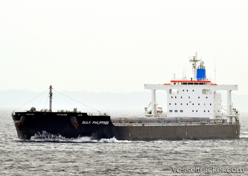
 FALBALA
Current Status
Where is the vessel?
FALBALA is currently in 104 nm E of Evans Landing, based on AIS data received less than 1h ago.
Latest AIS update:
Current position: 12.85001° S, 143.62096° E (104 nm E of Evans Landing)
Average speed (last 7 days): Loading…
Average speed (last 30 days): Loading…
Vessel profile: FALBALA is a Bulk Carrier with dimensions m x m.
This page combines live AIS, route history, probable destination signals, nearby traffic, and port activity for practical vessel monitoring.
The current position of vessel FALBALA is -12.85001 lat / 143.62096 lng. Updated: 2026-04-24 18:10:05 UTCNearest reference points:
- Near Thursday Island
- Near Torres Strait
Currently sailing under the flag of Bahamas ![]()
Details:
Live Vessel FALBALA Analytics (details, animations, etc.)
Recent AIS points (UTC):
2026-04-24 14:15:37 UTC · -12.16430, 143.23795 · SOG 13 kn · COG 172°2026-04-24 15:54:14 UTC · -12.46195, 143.38715 · SOG 12.1 kn · COG 147°
2026-04-24 16:10:23 UTC · -12.50929, 143.41463 · SOG 11.9 kn · COG 148°
2026-04-24 18:10:05 UTC · -12.85001, 143.62096 · SOG 12.3 kn · COG 124°