 vesseltracker.com
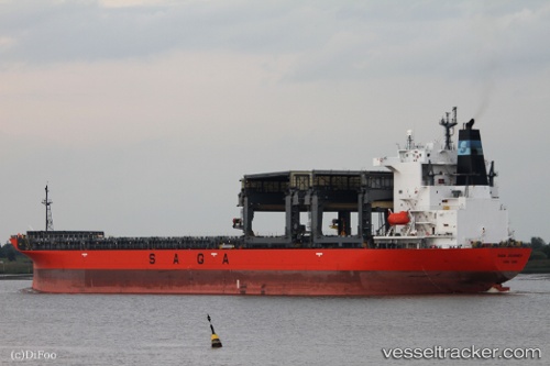
 SAGA JOURNEY
Current Status
Where is the vessel?
SAGA JOURNEY is currently in 70 nm W of Florida Straits, based on AIS data received less than 1h ago.
Latest AIS update:
Current position: 24.66868° N, 84.24601° W (70 nm W of Florida Straits)
Average speed (last 7 days): Loading…
Average speed (last 30 days): Loading…
Vessel profile: SAGA JOURNEY is a General Cargo with dimensions m x m.
This page combines live AIS, route history, probable destination signals, nearby traffic, and port activity for practical vessel monitoring.
The current position of vessel SAGA JOURNEY is 24.66868 lat / -84.24601 lng. Updated: 2026-05-15 13:23:45 UTCNearest reference points:
- 14 nm W of Florida Straits
- 78 nm SW of Boca Grande
- 40 nm S of Florida Straits
Currently sailing under the flag of Bahamas ![]()
Details:
Live Vessel SAGA JOURNEY Analytics (details, animations, etc.)
Recent AIS points (UTC):
2026-05-15 09:57:06 UTC · 25.24793, -84.69510 · SOG 12.5 kn · COG 146°2026-05-15 11:22:53 UTC · 25.00117, -84.50391 · SOG 12.2 kn · COG 144°
2026-05-15 13:23:45 UTC · 24.66868, -84.24601 · SOG 11.6 kn · COG 141°
2026-05-15 13:23:45 UTC · 24.66868, -84.24601 · SOG 11.6 kn · COG 141°