 vesseltracker.com
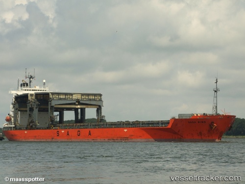
 SAGA WIND
Current Status
Where is the vessel?
SAGA WIND is currently in 207 nm N of Cockburn Harbour, based on AIS data received less than 1h ago.
Latest AIS update:
Current position: 24.77133° N, 70.40433° W (207 nm N of Cockburn Harbour)
Average speed (last 7 days): Loading…
Average speed (last 30 days): Loading…
Vessel profile: SAGA WIND is a General Cargo with dimensions m x m.
This page combines live AIS, route history, probable destination signals, nearby traffic, and port activity for practical vessel monitoring.
The current position of vessel SAGA WIND is 24.77133 lat / -70.40433 lng. Updated: 2026-04-23 13:13:07 UTCCurrently sailing under the flag of Bahamas ![]()
Details:
Live Vessel SAGA WIND Analytics (details, animations, etc.)
Recent AIS points (UTC):
2026-04-23 09:06:21 UTC · 25.05741, -71.21205 · SOG 10.7 kn · COG 111°2026-04-23 10:47:40 UTC · 24.95434, -70.89291 · SOG 11.3 kn · COG 110°
2026-04-23 13:13:07 UTC · 24.77133, -70.40433 · SOG 11.8 kn · COG 111°
2026-04-23 13:13:07 UTC · 24.77133, -70.40433 · SOG 11.8 kn · COG 111°