 vesseltracker.com
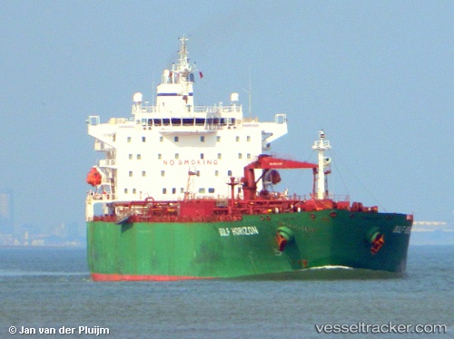
 JAG SPARROW
Current Status
Where is the vessel?
JAG SPARROW is currently in 50 nm E of Thorshavn, based on AIS data received less than 1h ago.
Latest AIS update:
Current position: 61.94362° N, 4.30643° W (50 nm E of Thorshavn)
Average speed (last 7 days): Loading…
Average speed (last 30 days): Loading…
Vessel profile: JAG SPARROW is a Oil Products Tanker with dimensions m x m.
This page combines live AIS, route history, probable destination signals, nearby traffic, and port activity for practical vessel monitoring.
The current position of vessel JAG SPARROW is 61.94362 lat / -4.30643 lng. Updated: 2026-05-16 15:41:59 UTCNearest reference points:
- 36 nm NW of Ham Voe, Foula
- 32 nm NW of Eshaness
- Near FUGLAFJORDUR
Currently sailing under the flag of Bahamas ![]()
Details:
Live Vessel JAG SPARROW Analytics (details, animations, etc.)
Recent AIS points (UTC):
2026-05-16 12:11:58 UTC · 62.51958, -3.09675 · SOG 14.1 kn · COG 227°2026-05-16 13:11:56 UTC · 62.35709, -3.46108 · SOG 13.6 kn · COG 228°
2026-05-16 13:27:58 UTC · 62.31553, -3.55450 · SOG 13.4 kn · COG 229°
2026-05-16 15:41:59 UTC · 61.94362, -4.30643 · SOG 14.5 kn · COG 214°