 vesseltracker.com
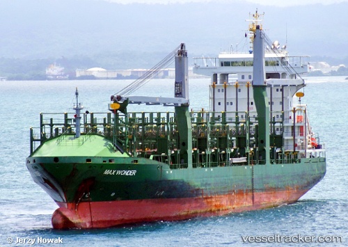
 CMA CGM EAST
Current Status
Where is the vessel?
CMA CGM EAST is currently in 16 nm E of Il-Kappara, based on AIS data received about 1h ago.
Latest AIS update:
Current position: 35.83333° N, 14.88833° E (16 nm E of Il-Kappara)
Average speed (last 7 days): Loading…
Average speed (last 30 days): Loading…
Vessel profile: CMA CGM EAST is a Container Ship with dimensions m x m.
This page combines live AIS, route history, probable destination signals, nearby traffic, and port activity for practical vessel monitoring.
The current position of vessel CMA CGM EAST is 35.83333 lat / 14.88833 lng. Updated: 2026-05-16 15:35:23 UTCNearest reference points:
- 18 nm E of Il-Kappara
- 13 nm E of Il-Kappara
- Near Xghajra
Currently sailing under the flag of Bahamas ![]()
Details:
Live Vessel CMA CGM EAST Analytics (details, animations, etc.)
Recent AIS points (UTC):
2026-05-16 12:19:14 UTC · 35.83361, 14.88935 · SOG 0 kn · COG 328°2026-05-16 14:01:16 UTC · 35.83386, 14.88980 · SOG 0.1 kn · COG 325°
2026-05-16 14:05:16 UTC · 35.83333, 14.88833 · SOG 0 kn · COG -1°
2026-05-16 15:35:23 UTC · 35.83333, 14.88833 · SOG 0 kn · COG -1°